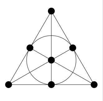
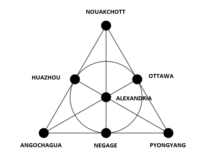
Despite my despair at creating a Connect Fano Plane in the spirit of a normal Connect Wall, I think I succeeded, thanks to the database of world cities I downloaded from Geo Data Source. In this iteration, you are given seven municipalities from around the world. Your job is to determine seven categories such that the municipalities and the categories form a Fano plane, as in this diagram:
For those of you who did not see the previous iteration, the rules are:
- The municipalities are the points, and the categories are the lines (the circle is a "line").
- A municipality can only be in the three categories corresponding to adjacent lines, and must specifically not match the other categories.
If you get the categories correct, there is a final connection (spoiler: it's a municipality) that matches all seven categories. A complete answer consists of the Fano diagram with the municipalities placed, a description of the seven categories, and the final connection. Ready?
ALEXANDRIA, ANGOCHAGUA, HUAZHOU, NEGAGE, NOUAKCHOTT, OTTAWA, PYONGYANG
Note: ALEXANDRIA refers specifically to the largest city in the world with that name.
As an early hint:
Three of the categories decribe geopolitical properties of the municipalites; four are language properties of their names (as transliterated here).
GOOD LUCK!


