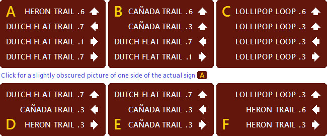
On a recent amble, I happened upon a sign $\small \raise2mu ( {\normalsize\sf\color{#d90} A} \raise2mu )$ that seemed to indicate a mistake — or— a mystery.
Really, sign $\normalsize\sf\color{#d90} A$, really? Dutch Flat Trail is in both directions and on the way to itself? This turned out to signify both, a mistake and a mystery!
The mistake was not in the information but in the design of its portrayal. The numbers shown are true travel distances from these signs, although separated unhelpfully from additional information not shown. (Distances were originally in miles, incidentally, but this version is not locali${\kern2mu \sf\scriptsize \rlap{ \raise8.5mu s } \raise-2mu z \kern2.5mu}$ed.)
The mystery is: What information is missing?
Spawned puzzle: What sequence of signs describes the longest non-overlapping trail route?
Start at the park entrance.
•
The sign there differs from the others in a reasonable way.
•
All signs are at three-path ⊥-shaped junctions,
as shown by arrows,
of two or three trails.
•
No sign may be visited more than once.
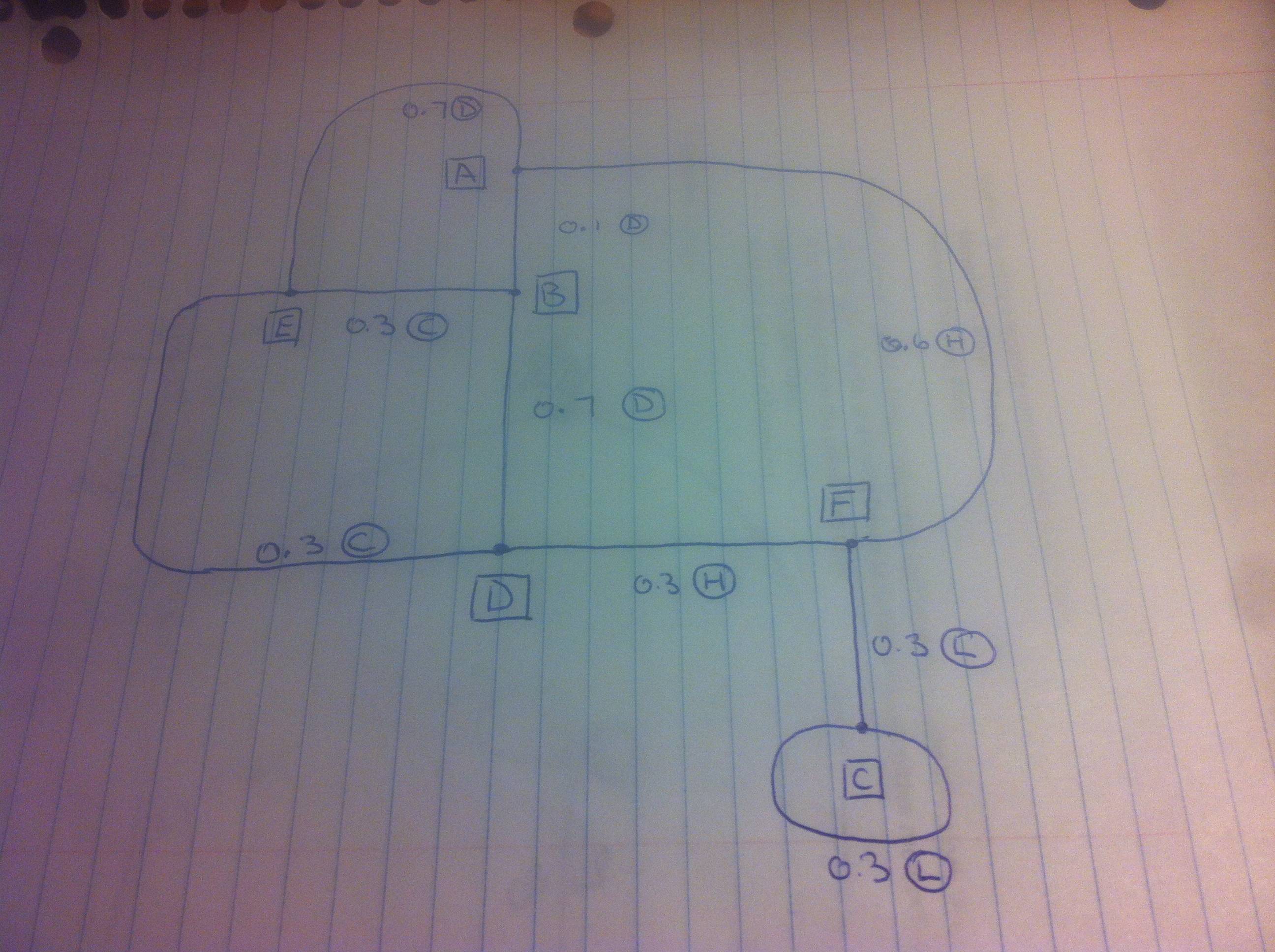
Every junction is represented by its sign above, so you won't need to enjoy exploring the park in order to figure out the layout of its trails or the meanings of these distances. Trails meander and do not obey geodesic constraints such as triangle inequality.
This requires no electronic technology to solve and is just a puzzlingly presented example of an actual public-park sign-design puzzle solution gone awry the wild. Every park's layout is already like a puzzle whose clues are trail signs, which many visitors find puzzling enough even when they are sensibly designed. I really did have to figure out what these meant-to-be-helpful signs really meant.


